Landmarks of the Arizona Strip
Together, the Arizona Strip and Southern Utah present many interesting landmarks, from rivers to mountains. Don't miss out on these hidden gems in the desert!
Icons of the Region
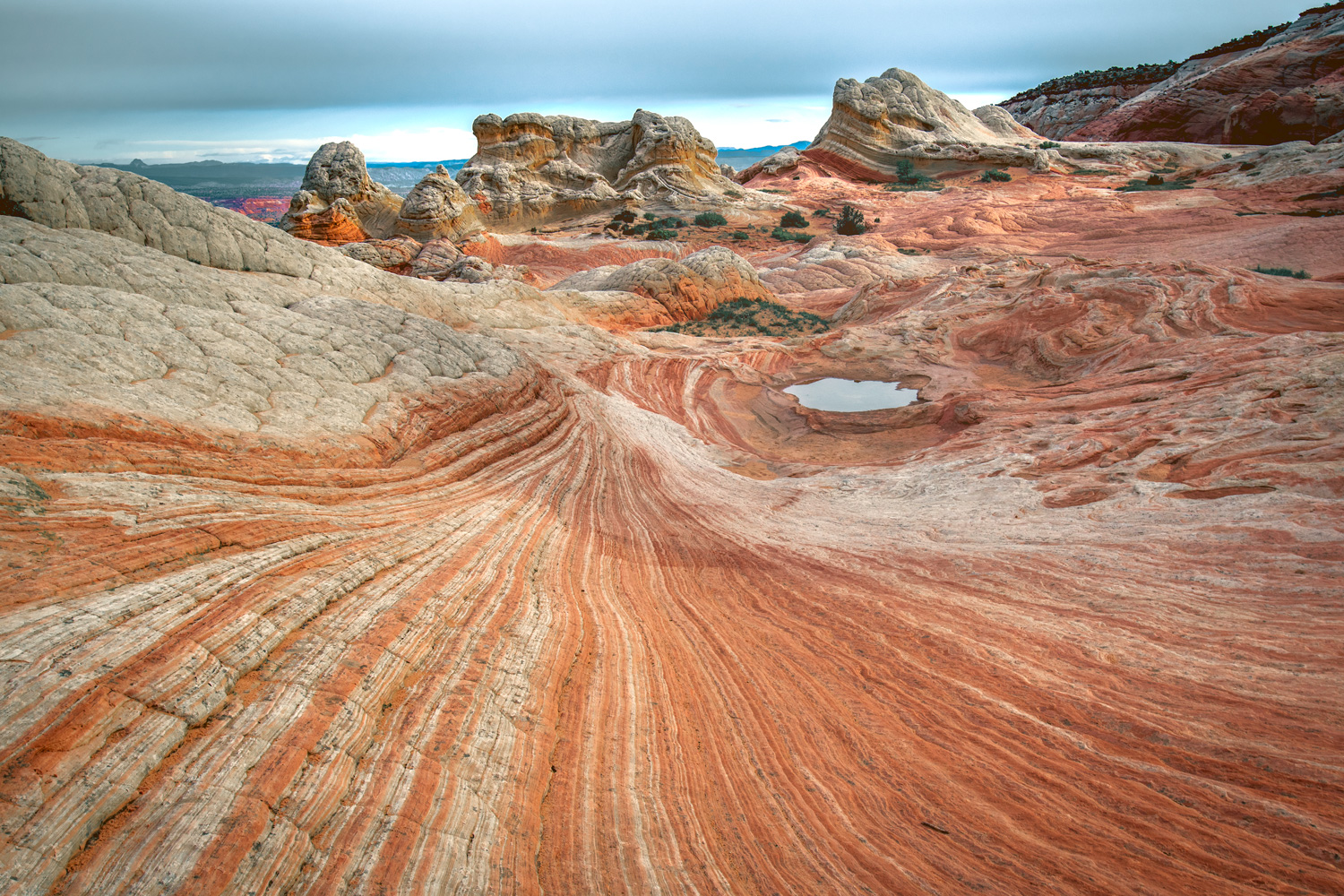
Vermilion Cliffs National Monument
The Vermilion Cliffs boast a rich tapestry of colors and are home to the renowned "The Wave" rock formation. This monument is a haven for hikers and photographers seeking the vibrant and surreal landscapes sculpted by eons of geological activity.
Kaibab National Forest
Encompassing a significant portion of the Arizona Strip, the Kaibab National Forest is home to diverse flora and fauna. A must-visit for anyone looking to immerse themselves in nature, it offers opportunities for hiking, camping, and wildlife viewing.
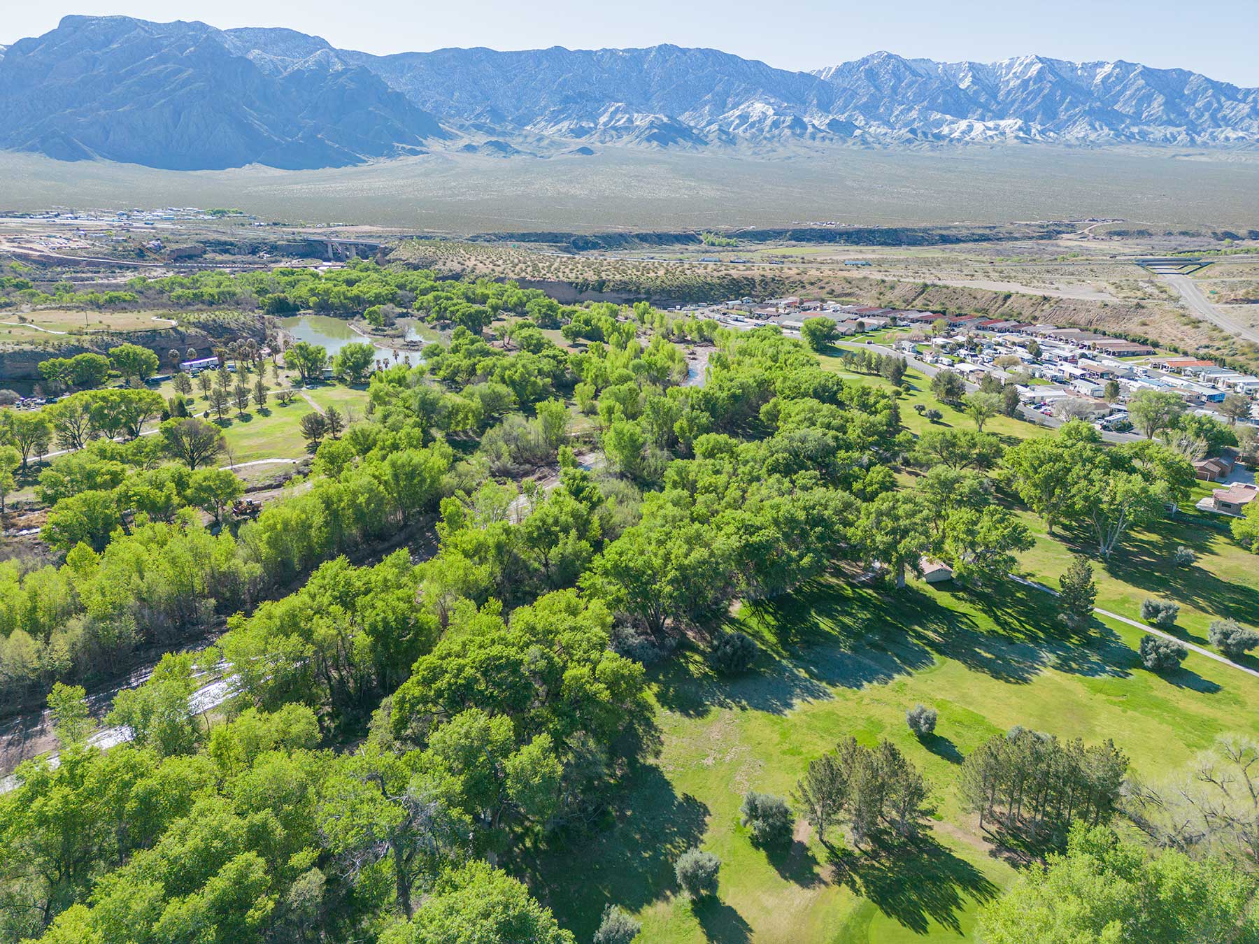
Virgin River Gorge
Located along Interstate 15, nestled in the heart of the Arizona Strip—possibly the most traveled part of the region—lies the Virgin River Canyon Recreation Area. Situated 20 miles southwest of St. George, Utah, and 20 miles northeast of Mesquite, Nevada, this natural oasis beckons outdoor enthusiasts with its myriad of trails, wildlife viewing opportunities, and river activities. The area boasts two designated wilderness zones, ensuring nature lovers a pristine experience. Furthermore, the Virgin Gorge Outlook offers visitors a panoramic view of the canyon, intricately carved by the Virgin River below. The mesmerizing interplay of light and shadow on the canyon walls encapsulates the sheer beauty of the Southwest’s rugged landscapes.
Old Spanish Trail
The Old Spanish Trail, a historic trade route that once connected Santa Fe to Los Angeles in the 19th century, winds its way through the breathtaking Mojave Desert, including parts of Southern Utah, Nevada and the Arizona Strip. Visitors today can follow remnants of this ancient path, delving into the rich history of exploration and trade. This trail provides insights into the lives of traders, settlers, and indigenous communities that once thrived along its route, inviting contemporary explorers to walk in the footsteps of early pioneers.
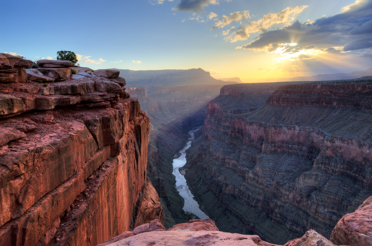
Toroweap Overlook
Toroweap Overlook, perched high on the North Rim of the Grand Canyon, offers one of the most dramatic views due to its sheer vertical drop to the Colorado River below. This remote vantage point guarantees fewer crowds, ensuring a serene and untouched experience. Its breathtaking perspective makes it a favorite for photographers and adventurers alike, promising a unique and tranquil immersion into the Grand Canyon's grandeur.
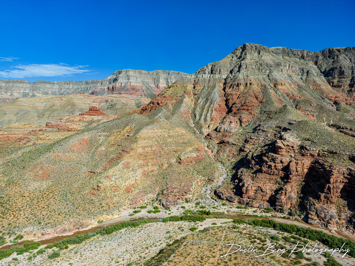
Grand Canyon-Parashant National Monument
The Grand Canyon-Parashant National Monument, often less visited than the Grand Canyon National Park, offers a pristine view of the Grand Canyon's dramatic vastness. With its deep canyons, mountains, and lonely buttes, this area gives visitors a sense of solitude and wilderness.
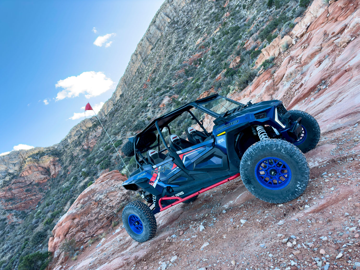
Mount Trumbull
Mount Trumbull, an extinct volcano, stands as a majestic beacon in the Arizona Strip, offering hikers unparalleled panoramic views of the region. The Mount Trumbull Loop, a favored trail among enthusiasts, weaves through the landscape, showcasing not just the natural splendor but also hinting at the area's history with remnants of old homesteads. Furthermore, for UTV (Utility Terrain Vehicle) enthusiasts journeying to the North Rim of the Grand Canyon, Mount Trumbull has become a favorite pitstop. Its rugged terrains and scenic vistas provide an adventurous detour, making it a must-visit spot in the vast expanse of the Arizona wilderness.
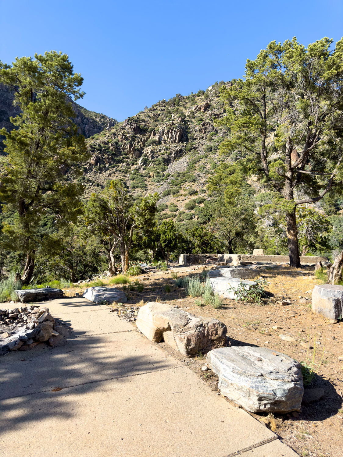
Pipe Spring National Monument
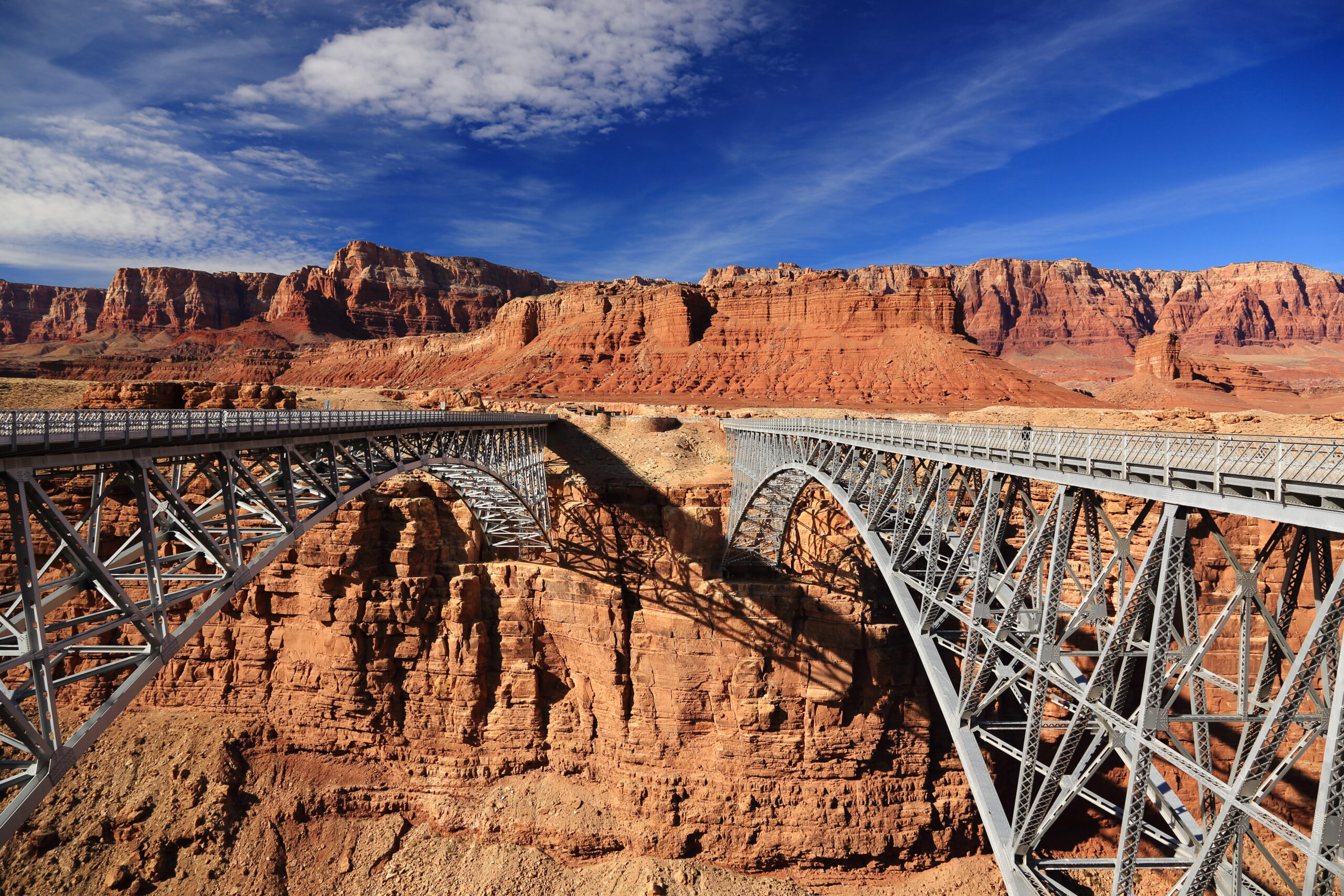
Navajo Bridge
In the Region
Don't Miss Gold Butte
Visiting Tips
Toroweap and the North Rim are seasonal. The Grand Canyon North Rim facilities operate roughly mid-May through mid-October, and high-elevation roads on the Kaibab Plateau close with winter snow. Toroweap Overlook is reached by a long unpaved road with no services — allow most of a day and bring a full-size spare.
Most landmarks are free to visit, but check first. Vermilion Cliffs National Monument, Grand Canyon-Parashant, and the surrounding BLM lands have no entrance stations, though specific areas (like The Wave in Coyote Buttes) require advance permits awarded by lottery.
Plan fuel and water around the pavement. Once you leave I-15, US-89A, or AZ-389, assume there are no gas stations, no stores, and no reliable water until you return. St. George, Mesquite, Fredonia, and Kanab are the natural staging towns.
Get the Recreation Guide!
All Around Mesquite, Nevada: History, Trails, & Destinations, meticulously details and maps the terrain and history of the Mesquite Region.
This publication features engaging content on UTV trails and captivating stories from a bygone era, showcasing the unique aspects of the area we live in.
Planning a Trip to the Strip?
Questions about access, seasons, or where to start — we are happy to help.