Kaibab National Forest
An island of pines a mile and a half in the sky — the cool green roof of the Arizona Strip.
A Cool Pine Forest Floating Above the Desert
Drive almost anywhere across the Arizona Strip and you are surrounded by open desert, sage flats, and bare rock. Then the land tilts upward, the air turns cool, and you enter a different world entirely: the North Kaibab, a high plateau cloaked in ponderosa pine, spruce, fir, and shimmering stands of aspen. It rises to roughly 8,000 to 9,000 feet, and that elevation is the whole story. While the canyon country below bakes in summer, the plateau stays comfortable, green, and quiet.
This is the North Kaibab Ranger District of the Kaibab National Forest, the section that sits north of the Colorado River and caps the Strip's eastern reaches. Locals and old maps often just call it the Kaibab Plateau. For travelers, it serves two roles at once: a destination in its own right for camping, wildlife, and forest drives, and the green gateway you pass through to reach the Grand Canyon's North Rim.
AZ-67 and Jacob Lake: The Road to the North Rim
If the North Rim is on your itinerary, the route is simple to remember. Highway 89A climbs the plateau and meets State Route 67 at Jacob Lake, the small forest junction that functions as the unofficial doorstep to the high country. From there, AZ-67 runs south for the length of the plateau, threading through pine and meadow before delivering you to the rim, the Grand Canyon Lodge, and Bright Angel Point.
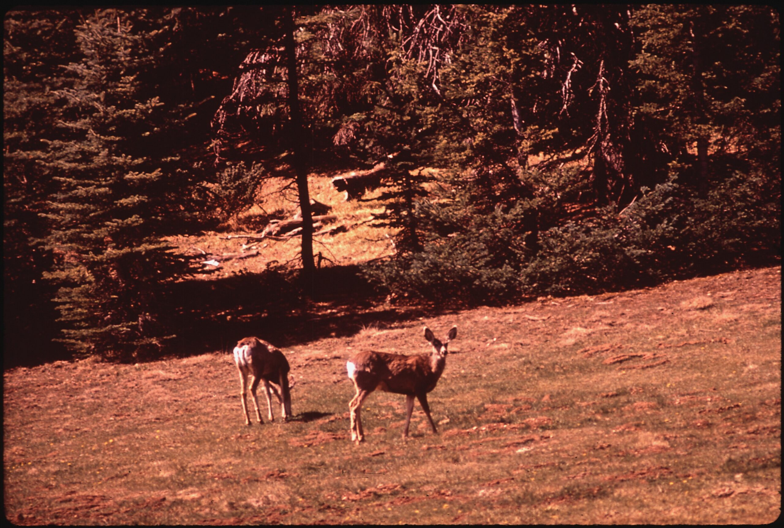
The drive itself is part of the experience. Long forest corridors open into broad grassy meadows where mule deer graze in the early evening and, if you are lucky, you may glimpse the plateau's small, isolated herd of Kaibab squirrels with their distinctive tufted ears. Slow down, roll the windows down, and treat the road as scenery rather than a transit corridor.
What There Is to Do Up Top
The plateau rewards travelers who linger. Even a half day on top is a relief from the desert heat and a chance to walk among trees that simply do not grow down on the Strip.
- Forest camping and dispersed sites. The North Kaibab is national forest, so dispersed camping is generally allowed away from developed areas, alongside established campgrounds. It is a popular, low-key alternative to staying inside the national park.
- North Rim viewpoints and trails. At the end of AZ-67, the rim opens up at Bright Angel Point and the Grand Canyon Lodge, with forest paths such as the Widforss and Uncle Jim trails nearby and the North Kaibab Trail dropping into the canyon toward the Supai Tunnel and Roaring Springs.
- Rim-edge backroads. Forest roads branch off AZ-67 toward less-visited overlooks along the canyon's edge, including the Rainbow Rim area, where a string of points looks out over the side canyons. These are unpaved and best suited to high-clearance vehicles.
- Wildlife and fall color. Deer, wild turkey, and the rare Kaibab squirrel are common sightings, and the aspen groves turn gold in autumn, one of the region's best seasonal displays.
The North Rim of the Grand Canyon
The North Rim is what the Arizona Strip is best known for, and the plateau is how you get there. Because it sits higher and farther from the nearest interstates than the busy South Rim, it draws a fraction of the crowds and feels far more remote. The views are no less staggering, only quieter.
Keep in mind that the North Rim and the forest plateau around it are seasonal. The full North Rim experience is built around the warm months, and a visit here pairs naturally with the broader sweep of canyon country to the west, including Toroweap and the vast backcountry of Grand Canyon-Parashant National Monument.
Seasonal Access: The Single Most Important Thing to Know
The North Kaibab is high country, and high country closes. Heavy winter snow shuts down AZ-67 and the road to the North Rim for roughly half the year, typically from late fall until late spring. When the highway is gated, there is no driving access to the rim from this side, and the forest roads on the plateau are snowbound.
The practical window for most visitors runs from roughly mid-spring through mid-autumn, with summer and early fall the most reliable. Before you commit to the drive, always check current road and rim status, because exact opening and closing dates shift every year with the snowpack. Treat any date you read online as approximate and confirm before you go.
Plan Your Visit
A little preparation turns the plateau from a place you pass through into a highlight of the trip.
- Fuel and supplies: Top off your tank before you climb. Services are sparse on the plateau, so the gateway towns are your last dependable stops. Coming from the north or west, Fredonia and Kanab are the practical staging points.
- Dress in layers: Even in summer, the elevation means cool mornings and chilly nights. Afternoon thunderstorms are common in mid- to late summer.
- Bring your own water: Carry plenty for the day, especially if you plan to hike, drive backroads, or camp away from developed sites.
- Mind the seasons: Plan around the AZ-67 opening window and verify the road and North Rim are open before setting out.
- Vehicle choice: The paved highway suits any car, but the rim-edge forest roads toward overlooks like Rainbow Rim call for high clearance and dry conditions.
For more of the high country and canyon-edge country nearby, see our landmarks guide and the wider Strip's recreation overview.
Plan Your Trip Around the Strip
Base your trip in one of the region's gateway communities.