Virgin River Gorge
Twenty miles of canyon so dramatic they ran an interstate through it — the Strip's grand western entrance.
A Canyon You Drive Straight Through
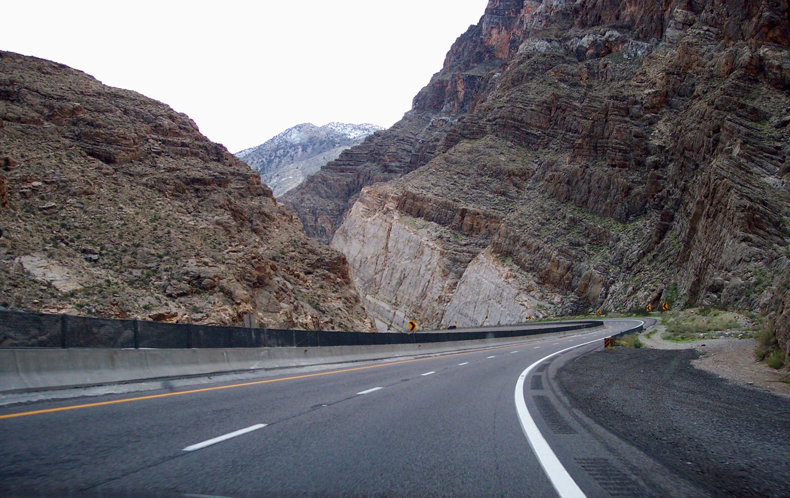
Most people meet the Virgin River Gorge at 75 miles an hour. The stretch of Interstate 15 between Littlefield, Arizona and St. George, Utah threads a roughly 12-mile slot through the Beaver Dam Mountains, with sheer rock walls rising on both sides of the pavement and the Virgin River braiding along the canyon floor beside you. It is one of the few places where a major American freeway is genuinely upstaged by its surroundings.
This short slice of northwest Arizona is also one of the most dramatic and least-acknowledged drives in the Southwest. There are no toll booths, no entrance gate, no "scenic byway" fanfare on the map. You simply round a bend out of the open desert near the Arizona-Nevada line and the mountains close in around you. If you are traveling between Las Vegas, Mesquite, and southern Utah, you will pass through it whether you plan to or not.
How the Gorge Got Here
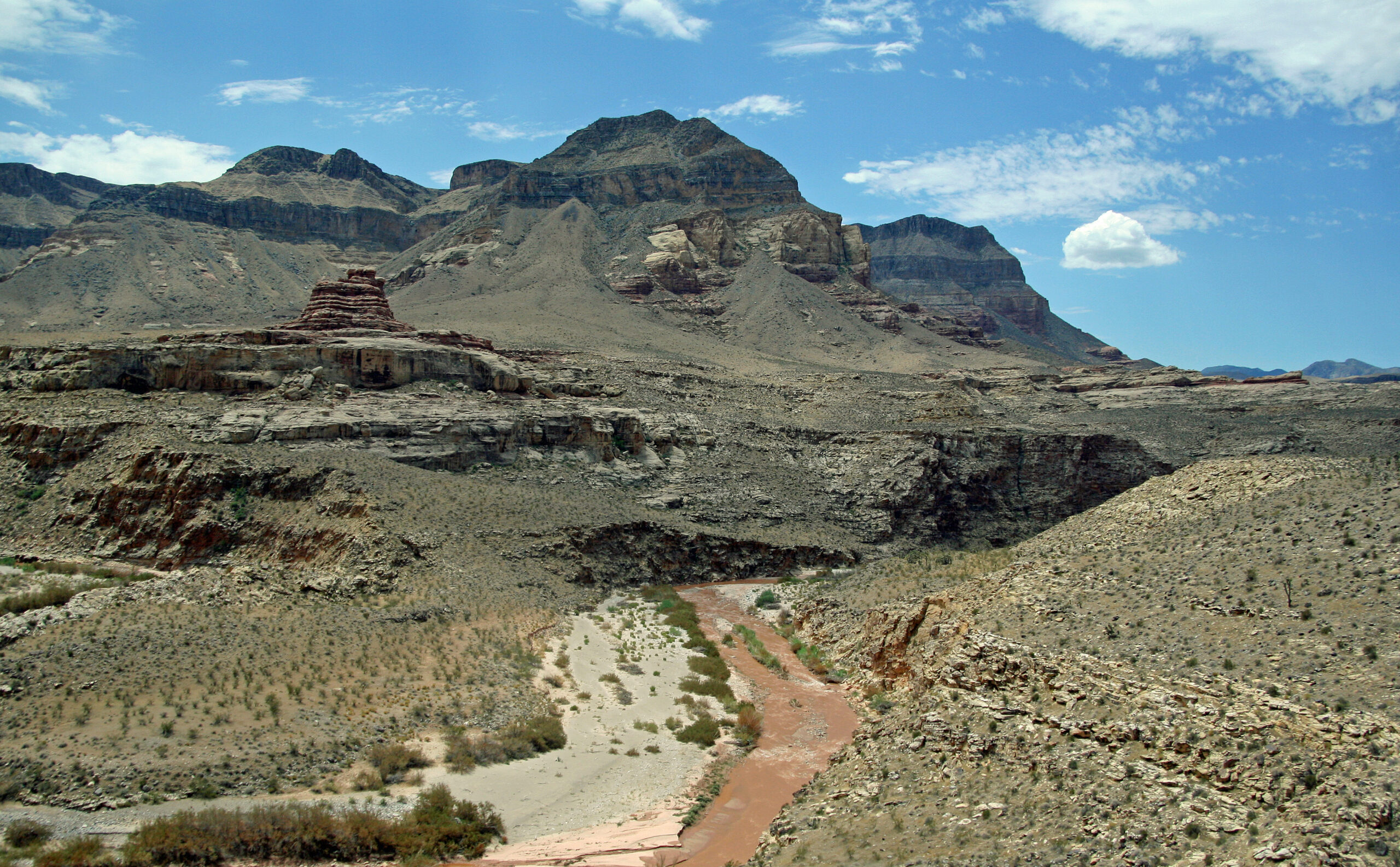
The gorge sits at a geologic crossroads, where the low, hot Mojave Desert gives way to the high country of the Colorado Plateau. Over an immense span of time, the Virgin River cut down through the uplifting Beaver Dam Mountains, exposing tilted and folded layers of limestone and older rock that record the region's restless past, shaped by erosion, faulting, and the slow grind of tectonic forces.
The result is the expansive, fractured rock you see from the highway: mesa-topped ridgelines, stair-stepped cliff faces, and a narrow inner canyon that the river still actively carves. It is the same river of erosion that, much farther upstream in Utah, sculpted the famous walls of Zion. Here the work is rawer and less polished, but the story is the same one written in stone.
Virgin River Canyon Recreation Area
The best way to actually stop and experience the gorge is the Virgin River Canyon Recreation Area, a Bureau of Land Management site reached directly off I-15 about 20 miles southwest of St. George (the Cedar Pockets exit). It is the rare freeway pull-off that rewards you for getting out of the car.
From the rim, the Virgin Gorge Outlook delivers a clean view down onto the canyon the river carved, where shifting light and shadow keep the walls changing through the day. Down at river level, the recreation area offers a base for several kinds of outings:
- Hiking on trails that drop toward the river and trace the canyon bottom
- Wildlife viewing in the riparian corridor, a green ribbon of life threaded through the dry country
- River access for wading, splashing, and exploring along the banks
- Camping at a developed campground with sites set right beneath the canyon walls
The site brushes up against two designated wilderness areas, which is part of why it feels so much wilder than its location beside a six-lane interstate would suggest.
Climbing and the Beaver Dam Backcountry
The Beaver Dam Mountains that the gorge slices through are a draw for climbers and backcountry travelers who want more than a roadside overlook. The wider Arizona Strip country around here, including spots like Limekiln Canyon, has long attracted sport climbers chasing the kind of untouched limestone and sandstone the region is known for.
Just outside the gorge, the Beaver Dam Wilderness protects a pristine tangle of canyons and peaks where the borders of Arizona, Nevada, and Utah meet. Congress set it aside as wilderness in 1986, and the BLM manages it as a refuge of rare plants, wildlife, and the kind of deep solitude that has become hard to find. It is foot-travel country: no roads, no services, just the terrain.
The River That Made the Region
The gorge is named for the water that built it. The Virgin River begins in the mountains of Utah and runs through three states, Utah, Arizona, and Nevada, before it finally joins the Colorado. Along the way it has been the single most important reason people could live out here at all.
That history runs both ways. The same river that watered the cotton fields and orchards of the early Virgin Valley settlements also turned on them, and a devastating flood in 1882 wrecked crops and homes downstream. Around Beaver Dam and Littlefield, the river still defines daily life. One casualty of the modern era sits right at the canyon's edge: Little Jamaica, also called Littlefield Springs, a beloved spring-fed swimming oasis beside the highway that was lost to interstate widening, though locals have talked of bringing it back.
Know Before You Go
The Virgin River Gorge is open and free to drive year-round, and the recreation area is reachable straight off I-15 at the Cedar Pockets exit. A few practical notes for making the most of a stop:
- Best seasons: Spring and fall are ideal. Summer in this low desert is genuinely hot, so plan hikes for early morning and carry far more water than you think you need.
- Fees: The BLM recreation area charges a day-use and camping fee. Bring cash for the self-pay station in case card payment isn't available.
- Fuel and supplies: Top off your tank and stock up in Mesquite or St. George. There are no services inside the gorge itself.
- Driving: The freeway through the canyon is curving and carries heavy truck traffic. Watch your speed, especially in rain, and use the marked exit rather than stopping on the shoulder.
- Backcountry: Routes into the surrounding wilderness and the wider Arizona Strip often need a high-clearance or 4x4 vehicle, plenty of water, and a paper map, as cell signal disappears quickly.
For more on the canyons, ranches, and overlooks that surround this stretch of the Strip, browse our full list of regional landmarks and things to do.
Plan Your Trip Around the Strip
Base your trip in one of the region's gateway communities.