Mount Trumbull
A pine-topped volcano in the middle of the desert — and the unlikely source of a temple's timber.
A Forested Island in the Desert
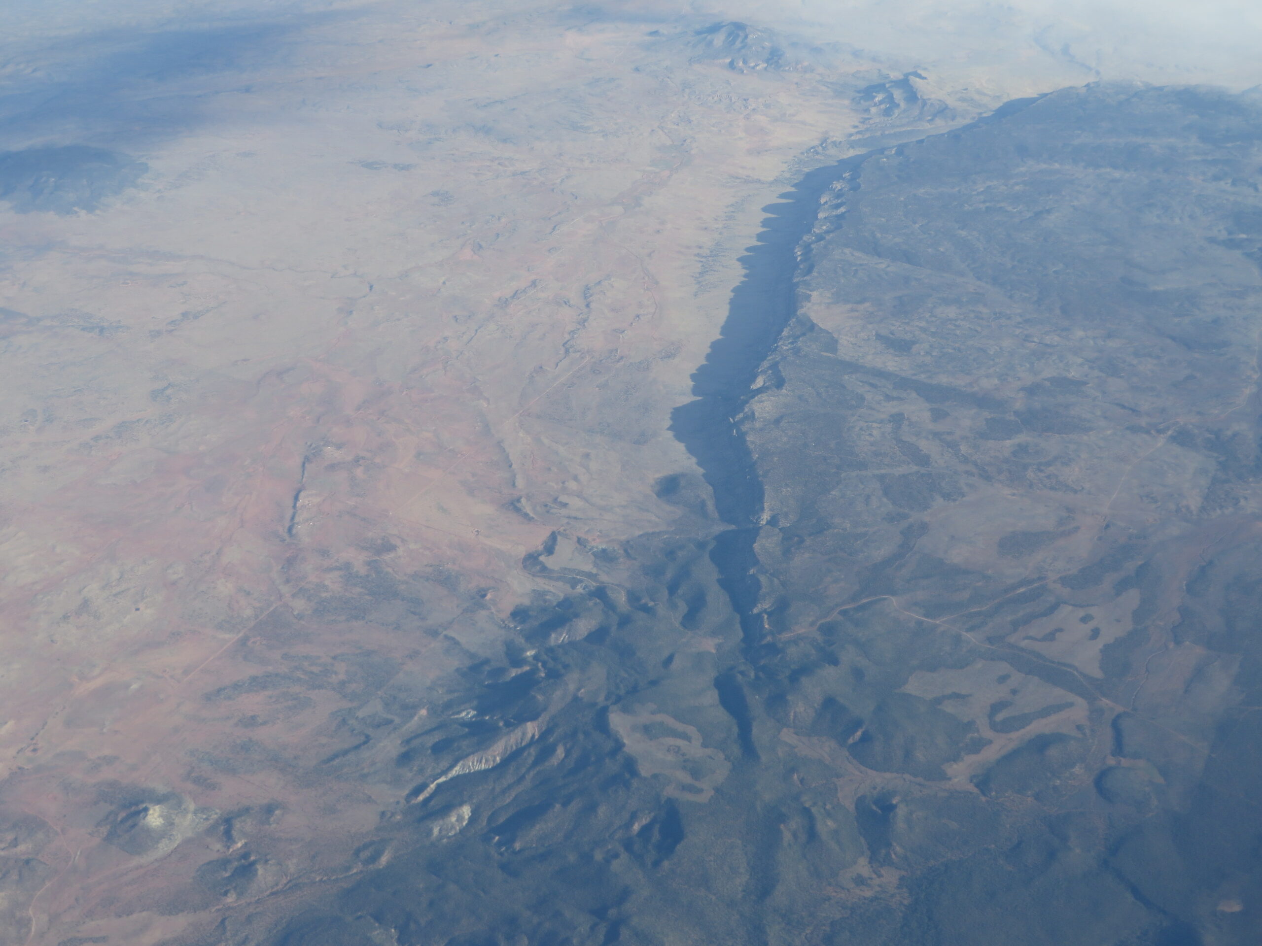
Mount Trumbull rises as a broad, pine-cloaked mesa in the heart of the Arizona Strip, the remote stretch of country north of the Colorado River and south of the Utah line. It belongs to the Uinkaret volcanic field, a cluster of old cinder cones and lava flows that left this corner of the Strip dark with basalt and, up high, green with timber. The mountain is part of the federally managed Grand Canyon-Parashant National Monument, a landscape so far from pavement that it stays empty even in peak season.
What surprises most first-time visitors is the forest. While the surrounding desert bakes in sagebrush and juniper, Trumbull's higher slopes carry stands of ponderosa pine and oak, a cool island of shade that feels transplanted from a mountain hundreds of miles away. That contrast, hot desert below and pine country on top, is the whole appeal of the place.
The Sawmill That Helped Build a Temple
Trumbull's pines are not just scenery. In the 1870s, settlers logged this mountain to supply lumber for the St. George Temple, and the wood was hauled north across miles of open desert toward the Utah valley. The route became known as the Temple Trail, and pioneers also used it on their long journeys to be married, which is why it carries the second name of the Honeymoon Trail.
Pieces of that history still sit out in the open. Along the old road you can spot stretches of hand-stacked rock and worn trail remnants left by the wagons that crossed here. The St. George Temple they were supplying was the first temple the LDS Church completed in Utah and remains its longest-operating one, which gives the timber cut on this quiet mountain an outsized place in the region's story. The Temple Trail itself threads down through Warner Valley well to the north, near the modern communities around Colorado City and the Utah border.
The Schoolhouse and the Old Settlement
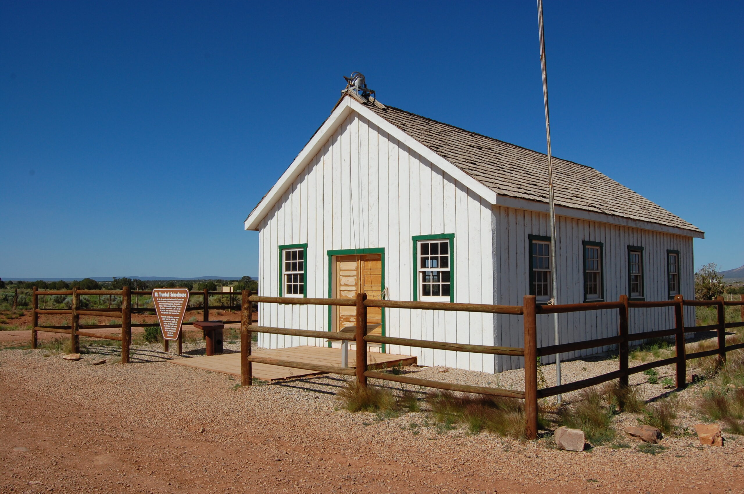
Below the mountain sat a small ranching and farming community that grew up around the sawmill era and the springs nearby. The settlement faded long ago, but a restored one-room schoolhouse still stands as the most visible reminder that families once made a life out here. It is a modest building in a big, silent valley, and reaching it is half the experience.
Treat the schoolhouse and the scattered homestead traces as you would any historic site: look, photograph, and leave everything where it lies. There are no staff, no fences, and no one coming to repair what gets disturbed.
The Loop Drive and the Summit Trail
For most travelers, Mount Trumbull is a driving-and-day-hiking destination rather than a quick stop. The backcountry loop that circles through the Uinkaret country strings together the schoolhouse, the volcanic terrain, and long views over the Strip, and it pairs naturally with a side trip toward the canyon rim overlook at Toroweap for those equipped to go farther.
A foot trail climbs from the desert floor up through the pines toward the summit area. It is a real hike, not a stroll, gaining elevation through forest with rewarding views, and it sees very little traffic. Plan on:
- A half-day or more once you factor in the long approach drive
- Sturdy footwear, since the route is rocky and unmaintained in spots
- Far more water than you think you need, carried up from your vehicle
- No cell signal and no help within easy reach
Getting There
Access is the single biggest thing to understand about Mount Trumbull. The mountain sits at the end of long, graded dirt roads reached from the small gateway towns on the edge of the Strip, typically by way of Fredonia and Kanab on the eastern side or via the monument's western approaches. These are remote roads measured in dozens of miles, not blocks.
A high-clearance vehicle is strongly recommended, and four-wheel drive is wise. The surface can be washboarded, rutted, or slick after rain, and the same roads that are passable in dry weather can turn impossible when wet. Always check current conditions with the BLM or National Park Service before committing to the drive.
Know Before You Go
This is genuine backcountry. There is no fuel, no water, no food, and no reliable phone coverage anywhere near the mountain, so you must be fully self-sufficient before you leave the highway.
- Fuel and water: top off the tank and carry extra water and food in the last real town you pass; the nearest services are far behind you.
- Season: late spring through fall is the usual window. The pine-topped elevation can hold snow and mud in winter, and storms make the dirt roads risky.
- Vehicle: high-clearance, ideally 4x4, with a full-size spare and basic recovery gear.
- Fees: there is no entrance booth or admission charge out here; the monument is undeveloped and unstaffed at the mountain.
- Tell someone: leave a route and a return time with a friend, since a breakdown could mean a long wait.
If you want help planning a Strip itinerary that links Mount Trumbull with nearby destinations, our landmarks guide and recreation pages are a good place to start, or reach out with questions before you head into this beautifully empty corner of Arizona.
Plan Your Trip Around the Strip
Base your trip in one of the region's gateway communities.