A Long-Weekend Arizona Strip Itinerary: Mesquite to Kanab
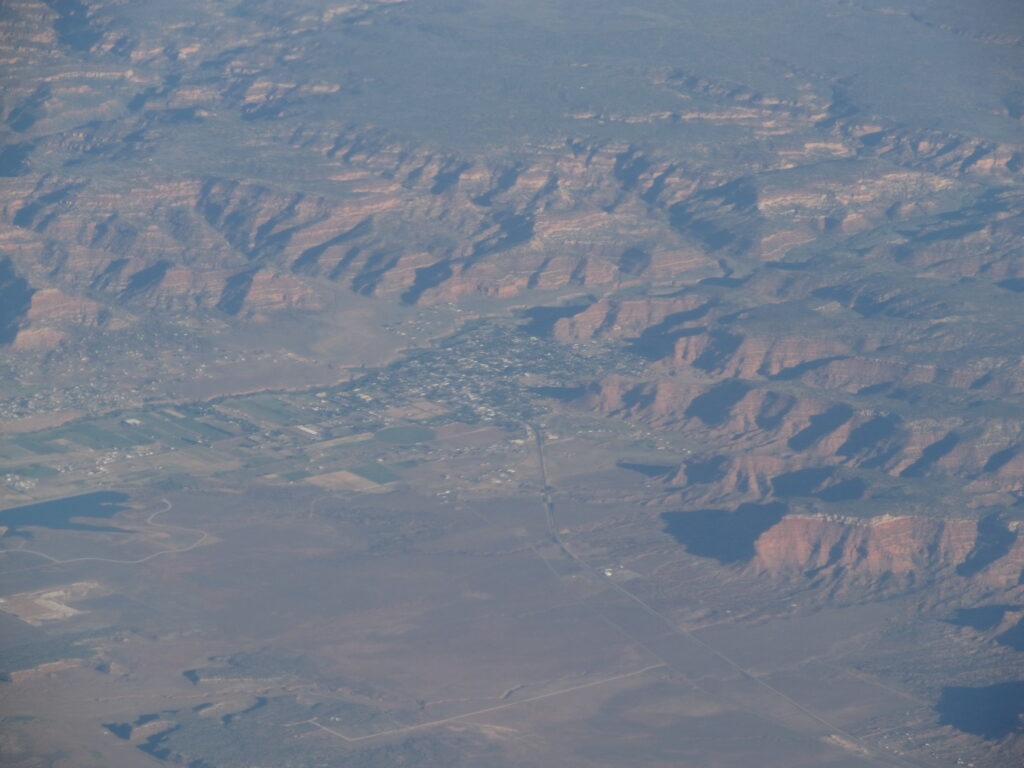
The Arizona Strip is one of the emptiest corners of the Lower 48 — more than three million acres of mesa, canyon, and pinyon-juniper sitting north of the Colorado River and cut off from the rest of Arizona by the Grand Canyon itself. There’s no fast way across it, and that’s exactly the point. Give yourself three days and you can run the whole thing west to east, from the casinos and golf greens of Mesquite to the cool Ponderosa forest of the Kaibab Plateau, watching the desert change beneath you the entire way.
This is a route, not a checklist. Distances are long, services are thin, and several of the best stops sit at the end of dirt roads. Plan fuel, water, and daylight accordingly, and treat the loose timeline below as a frame you can stretch or compress.
Day 1 — Mesquite, Gold Butte, and the Virgin River Gorge
Start in Mesquite, Nevada, tucked into the northeastern corner of Clark County where the Virgin River threads through Mojave desert flats. It’s an easy base: comfortable lodging, real coffee, and a surprising range of dinners — Thai, Greek, Italian, and Mexican all turn up here. Fuel up and stock the cooler, because the day heads into country with none of that.
Just south, across the Bunkerville bridge, lies Gold Butte National Monument — roughly 300,000 acres of red sandstone, hidden canyons, and the bones of old mining camps. This is the morning’s main event. A few worthwhile targets:
- Whitney Pocket — banded cream, rust, and amber sandstone set against grey peaks, and a favorite spot to camp or stretch your legs.
- Falling Man and Newspaper Rock — panels of ancient rock art etched into the desert varnish, a window into the people who passed through long before the miners.
- Little Finland and Devil’s Throat — wind-sculpted rock and a startling deep sinkhole, both pure desert oddity.
A word of caution: most of Gold Butte’s interior is reached by rough, sandy road, and a high-clearance or four-wheel-drive rig is the right call past the pavement. Cooler months are far kinder than summer. If you’re short on time or vehicle, the entrance area and Whitney Pocket still deliver.
In the afternoon, swing back through Mesquite and follow I-15 northeast into the Virgin River Gorge. The interstate carves straight through a dramatic chasm here, and the recreation area between Mesquite and St. George — which holds two designated wilderness areas — makes a fine spot to walk a riverside trail and watch the light move across the canyon walls before you settle in for the night.
Day 2 — Across AZ-389: Colorado City to Fredonia
Day two is the long traverse along the spine of the Strip. From the St. George area, drop south onto AZ-389 and roll east through high, open rangeland. Your first stop is Colorado City, the cluster of communities straddling the Arizona–Utah line that’s best known as a historic FLDS stronghold. The red cliffs rising behind town — and nearby Water Canyon, a popular local hike into a sandstone slot and waterfall — give the area a beauty that surprises first-time visitors. Stay respectful; people live and worship here.
Continue east to Pipe Spring National Monument, one of the few developed stops on this whole road. The fortified ranch house and reliable spring tell the story of survival on the Strip — Ancestral Puebloan and Kaibab Paiute presence, Mormon ranching, and the early cattle frontier all layered in one small site. It’s the right place to walk, learn, and use real restrooms before the road gets lonelier again.
Push on to Fredonia and, just across the line, Kanab, Utah — a high-desert town wrapped in red rock that has long served as a gateway to the Grand Canyon and a backdrop for Hollywood Westerns. Kanab is the natural overnight: it has the broadest range of food and lodging you’ll find for many miles. If you have energy left, climbing to a viewpoint like Fredonia Fire Point rewards you with the whole ever-changing landscape spread out below.
Day 3, Option A — The Kaibab Plateau and North Rim
For the classic finish, point south from Jacob Lake onto Highway 67 and climb the Kaibab Plateau. The shift is remarkable: within an hour the desert gives way to meadows and dense Ponderosa pine, and the air turns genuinely cool. The road dead-ends at the North Rim of the Grand Canyon, the quiet sibling of the busy South Rim.
- Grand Canyon Lodge and Bright Angel Point — a short, paved walk to one of the great canyon overlooks.
- North Kaibab Trailhead — for a taste of the descent (turn around well before you’re tired; this trail is no joke).
- Crazy Jug, Gunsight, or Bill Hall points — forest-road viewpoints for travelers who want the rim without the crowds.
Note that Highway 67 and North Rim services are seasonal — typically mid-May into autumn — and snow closes the plateau in winter. Confirm before you commit your last day to it.
Day 3, Option B — A Toroweap Backcountry Day
If you’d rather trade comfort for raw drama, aim instead for Toroweap, deep inside Grand Canyon–Parashant National Monument. There’s no lodge, no railing, and no quick way in — just a long, rough dirt road and, at its end, a sheer drop of roughly 3,000 feet straight to the Colorado River. It’s the most vertical view of the canyon you can find, and one of the most remote. Carry extra water, fuel, a full-size spare, and tell someone your plan; this is true backcountry where a flat tire becomes a serious problem.
Other big-country detours for the adventurous include Mount Trumbull and the legendary Bar 10 Ranch, a working cattle operation that has become the region’s recreation hub — a way to experience the Grand Canyon’s far western reaches well away from any crowd.
Extending the Trip
If a long weekend turns into a full week, the east end opens up further. The Vermilion Cliffs south and east of Kanab hide White Pocket’s swirling reds and whites, House Rock Valley, and the slot-canyon country around Buckskin Gulch and the Paria River. History buffs can trace segments of the Old Spanish Trail that once linked Santa Fe to Los Angeles across this same desert.
Before You Go
The Strip rewards preparation more than almost anywhere else. A few essentials: top off fuel at every town, carry far more water than feels reasonable, download offline maps because cell coverage vanishes fast, and check road and seasonal conditions before relying on any dirt route or the North Rim. Travel in spring or fall when you can — the summer heat down low is brutal, and the high country is locked up by snow in winter.
Browse the rest of our community guides and landmark pages to fine-tune your own version of this route. However you stitch it together, three days across the Arizona Strip will leave you with the rare feeling of having a corner of the West almost entirely to yourself.