Driving the Arizona Strip: Fuel, Road Conditions, and Vehicle Tips
The Arizona Strip is one of the emptiest corners of the Lower 48 — a vast wedge of mesa, canyon, and high desert cut off from the rest of Arizona by the Colorado River. That isolation is exactly what makes it magical, and exactly what makes driving here a planning exercise rather than an afterthought. Pavement is rare, services are rarer, and the dirt roads that fan out into the backcountry range from freshly graded to genuinely impassable. Here is how to move through the region without getting stranded.
The paved network is short — know it cold
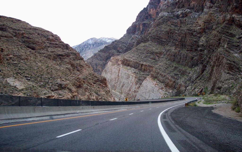
You can count the Strip’s paved roads on one hand, and they do most of the heavy lifting. Interstate 15 slices across the far northwestern corner, threading the dramatic Virgin River Gorge as it links Mesquite, Littlefield, and Beaver Dam with St. George, Utah. AZ-389 runs east toward Fredonia and Pipe Spring. US-89A climbs from Fredonia up onto the Kaibab Plateau and on toward the Grand Canyon’s North Rim, passing beneath the Vermilion Cliffs.
Almost everything else is dirt. The moment you leave these corridors, treat the trip as remote backcountry travel — because it is. Cell coverage drops to nothing within minutes, and the next paved road may be fifty miles away.
Fuel and water: top off, then top off again
The cardinal rule of the Strip is simple — fill the tank whenever you can, because you rarely can. Reliable fuel lives at the region’s edges: Mesquite, the Littlefield/Beaver Dam area off I-15, Colorado City, Fredonia, and Kanab just over the Utah line. Between those points, there is essentially nothing. A run out to Toroweap or deep into Grand Canyon-Parashant can easily exceed a hundred miles round trip on slow dirt, so plan your range conservatively and carry extra fuel for any serious backcountry loop.
Water matters even more. This is the Mojave’s northern reach, and the springs and seeps scattered across the map are wildlife sources, not drinking fountains. Bring far more water than you think you need — for you and for a radiator that may have to work hard in summer heat. A short list before you turn off the pavement:
- A full tank plus a reserve can for long loops
- Several gallons of drinking water, plus extra for the vehicle
- A full-size spare, a working jack, and a tire plug kit
- Paper maps or offline GPS — do not trust a single cell-dependent app
- Recovery basics: traction boards or a shovel for sand
What the dirt roads actually demand
Strip roads are deceptive. A route can start out smooth and well-graded, lull you into confidence, then deteriorate into bedrock ledges or deep sand without warning. The classic example is the 4WD run up Cabin Canyon Road toward Grand Canyon-Parashant: the lower stretches are often fine for a two-wheel-drive vehicle with moderate clearance, but the higher you climb, the rougher the bedrock gets, and weather can rewrite the whole road between visits.
For anything beyond the maintained main routes, high clearance is the baseline and 4×4 is strongly recommended. Popular destinations like Whitney Pocket and Nickel Creek over in Gold Butte are reached by bumpy, washboarded tracks where ground clearance is the difference between a great day and a cracked oil pan. Sandy stretches — the kind found on the red-rock routes near Beaver Dam — reward a short wheelbase and momentum, and punish overconfidence. When in doubt, scout obstacles on foot before you commit the truck.
Weather, washes, and clay: the hidden hazards
The fastest way to ruin a Strip trip is to ignore the sky. Many of the region’s roads run through or alongside washes — dry sandy channels that double as the main route on a clear day and become flash-flood corridors during a storm. Roads like Lower Toquop, which links the wash country around Mesquite, are prone to washing out; the power district grades them back to passable, but a fresh storm can undo that overnight.
Then there is the clay. When the Strip’s fine soils get wet, they turn to grease. Slopes that were trivial in the morning become un-climbable after an afternoon shower, and a route that trapped you in mud may not dry out for a day or more. Watch the forecast, watch the clouds, and never camp or park in the bottom of a wash. If rain is moving in, get yourself onto higher, firmer ground while you still can.
Mesquite: the OHV-friendly gateway
If you are running side-by-sides or UTVs, Mesquite is the place to base out of. The town has embraced off-road culture — there is an active local UTV scene, and a clever pair of large culvert tubes beneath I-15, where the Sand Hollow Wash crosses, lets riders move between town’s north and south halves without ever touching the interstate. From there, the trails open onto Gold Butte, the Mormon Mountains, and the broader Strip. Beaver Dam is similarly welcoming to off-roaders heading toward the red-rock playgrounds nearby.
Even so, OHV-friendly does not mean rules-free. Stay on existing routes, respect monument and wilderness boundaries (much of Parashant and the Kaibab has access restrictions), and pack out everything you bring in.
Before you go
The Arizona Strip rewards drivers who treat it with respect: fuel up at every chance, carry water and a real spare, check the weather, and match your vehicle to the route rather than the other way around. Tell someone your plan and your expected return time, since you may be hours from help. Get those basics right and the Strip opens up — from the historic trail corridors to the rim of the Grand Canyon. Start planning your route on our recreation guide and dig into the gateway communities that will fuel, feed, and launch your adventure.